

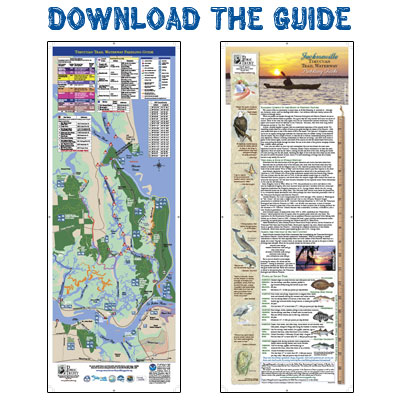
The guide consists of a map and narrative description of the network of waterways running between the Nassau River and the St. Johns River in north-eastern Duval County. We hope this guide and website will encourage people to use and enjoy the natural resources in the area. The waterway trails depicted on the map may be enjoyed anywhere from an hour to a full day, and most are accessible by both the experienced and novice paddlers. The parks highlighted in the guide can also be enjoyed on foot.
The map includes launch points (most of which have a nominal $1 - $4 user’s fee), amenities available at the parks, and GPS coordinates for the trails. Some of the areas have strong currents and/or heavy boat traffic, so be careful! The map contains several different warning markers and these warnings should be taken into consideration by all paddlers. Watch the tides closely, as some of the waterways become dry during low tides, and paddlers may become stranded until the tide comes in again.